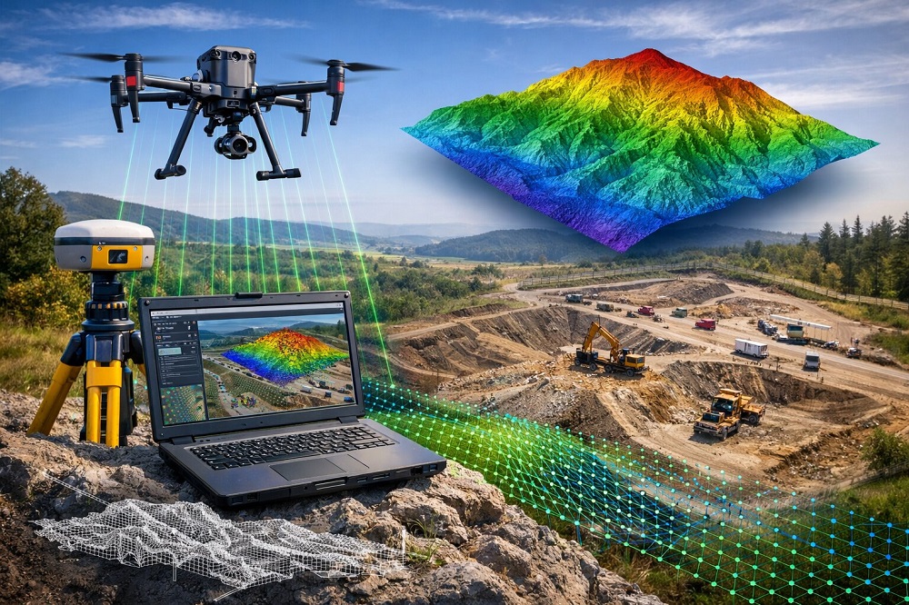
Drone technology is one of the modern methods used in surveying engineering to obtain fast, accurate and detailed data. Drone photogrammetry is the process of capturing aerial images using unmanned aerial vehicles and processing them with specialized software to generate high-precision mapping data. Koni Engineering provides reliable drone photogrammetry solutions for projects with its advanced equipment and expert team.
This method enables the surveying of large areas in a short time and provides significant advantages, especially in engineering projects. Through drone-based image acquisition, terrain characteristics are analyzed in detail and the collected data is processed digitally to generate various mapping products. The drone photogrammetry services provided by Koni Engineering contribute significantly to the planning and implementation stages of projects with a high level of accuracy.
Drone photogrammetry can be applied in many different fields. Thanks to the data obtained within the scope of this service, projects can be prepared more quickly and reliably.
- ✔ Topographic Base Map Production
- ✔ Terrain Modeling Studies
- ✔ 3D Terrain Model Generation
- ✔ Volume Calculation Studies
- ✔ Construction Site and Project Progress Monitoring
- ✔ Mapping and Planning Studies
Thanks to drone technology, fast surveys can be carried out even in large and hard-to-access areas. Koni Engineering provides high-precision surveying and mapping solutions for projects using advanced drone systems and professional data processing methods, contributing to more efficient engineering workflows.
For more detailed information, you can visit our contact page and follow us on our social media accounts.