Precise Analysis of Underwater Bottom Topography
Koni Engineering provides bathymetric mapping services for lakes, dams, rivers, ports and coastal areas. Accurate modeling of underwater bottom morphology is critical for volume calculations, dredging planning and hydraulic design. With this awareness, our work includes high-precision measurements, controlled data processing and comprehensive technical reporting. Bathymetric maps represent underwater depth distribution through isobath contours. Using the generated digital terrain model, depressions, ridges, slopes and sediment accumulations within the project area are clearly analyzed, enabling engineering projects to be planned based on reliable data.
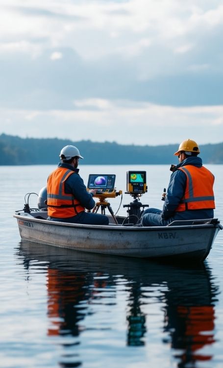
Surveying and Data Acquisition Process
Before starting the work, we prepare a detailed survey plan for the project area. We determine line spacing, data density and the reference system in accordance with the project requirements. In the field, we perform depth measurements using single-beam or multi-beam echo sounder systems, while maintaining horizontal and vertical positioning accuracy through RTK GNSS integration. After the field data is transferred to the office environment, it is processed through filtering and error correction procedures. Elevation adjustments are applied by taking water level variations into account. Isobath contours are then generated and a digital terrain model is created. We deliver the final results together with a technical report, cross-sections and volume calculations.
Areas of Application
Bathymetric mapping services provide a critical source of data especially for reservoir and pond volume calculations, dredging projects and port planning. They also serve as a fundamental engineering input for hydroelectric power plant projects, flood modeling studies and underwater structure design. An accurately produced bathymetric model helps ensure predictable project costs and minimizes risks during the implementation process.
Bathymetric Map Production
Koni Engineering carries out bathymetric map production not merely as a data collection process, but as a comprehensive engineering service planned and managed from start to finish. Every stage of the process, including pre-project preparation, field surveys, data evaluation, digital model generation and technical reporting, is conducted under controlled procedures by our expert teams. Our goal is to produce sustainable spatial data with proven technical accuracy that can be confidently used in engineering projects. For reliable results in underwater surveying applications, Koni Engineering stands by your side as a professional solution partner backed by engineering expertise.
For more detailed information, you can visit our contact page and follow us on our social media accounts.