Koni Mühendislik
Koni Mühendislik

Our company, which was established in 2015 to carry out Map Engineering Activities, continues its activities successfully with its expert staff and equipments today. Being the best among our competitors in the sector with our equipment suitable for today's conditions and experienced staff in the fields we operate is among our primary goals.
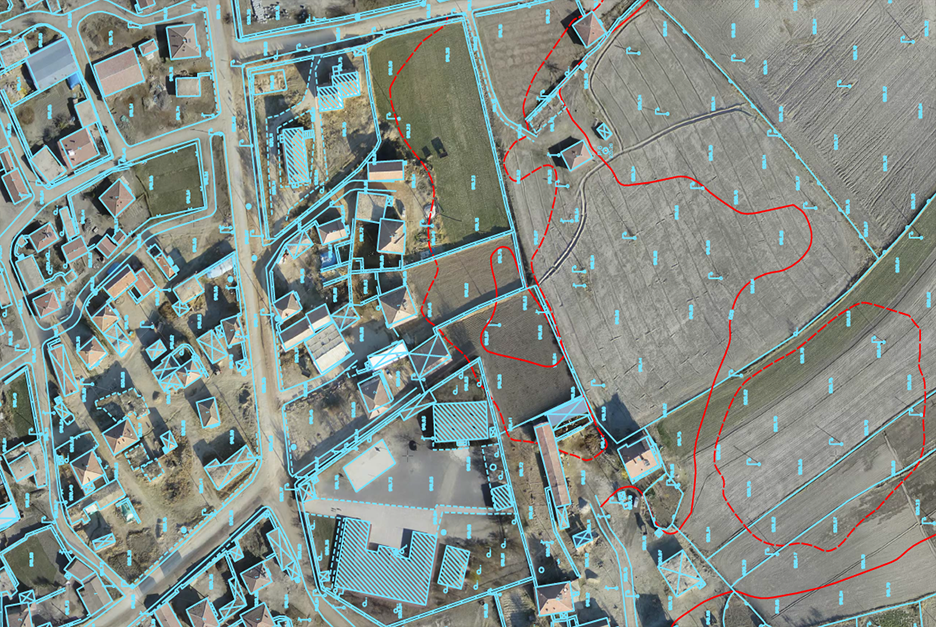
The word meaning of the present indicates the current situation. From this point of view, the current map means the map showing the current situation. Triangulation, polygon points, the number of floors in the buildings, buildings, RS points, sidewalks, streets, height curves in the outdoor area, streets, trees, electricity poles and existing building, field boundaries, etc. Everything in the area where the property is located is shown. Current Maps are made at 1/2500, 1/1000 or 1/2000 scale.
If it is necessary to define it briefly, the large-scale maps made by the Municipalities or Iller Bank for the purpose of project planning, design, implementation and operation of the services to be carried out by the municipalities, the zoning plan and the other projects mentioned above are called Baseline Maps. In order for the residences or workplaces to be built in areas outside the Zoning Plan areas to be licensed, the Local Zoning Plan and therefore the Base Map must be prepared.