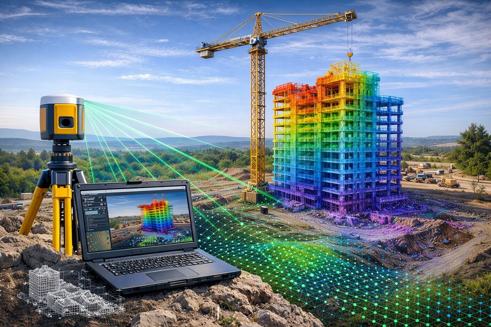
Advanced surveying techniques are used to obtain high-accuracy data in surveying engineering and 3D modeling studies. Point cloud generation is a key data production process that involves combining millions of measurement points acquired through laser scanning systems, drone technology and photogrammetry methods in a digital environment. Koni Engineering provides reliable and precise data production for projects with its modern surveying technologies and expert engineering team.
Today, 3D data plays a crucial role in the detailed analysis of terrain and structures in engineering projects. Through point cloud generation services provided by Koni Engineering, terrain characteristics, existing structures and environmental elements can be accurately transferred into the digital environment. This enables planning, analysis and design processes to be carried out more efficiently and reliably.
Point cloud data is used in a wide range of engineering and planning applications. These datasets enable more detailed analysis of projects and improve the efficiency of implementation processes.
- ✔ 3D Modeling Studies
- ✔ Digital Modeling of Terrain and Structures
- ✔ Laser Scanning Data Processing
- ✔ Data Production for Engineering Projects
- ✔ Measurement and Documentation of Existing Structures
- ✔ Planning and Analysis Studies
Data obtained using high-precision measurement devices and advanced software contributes to the preparation of more accurate and reliable projects. Through its advanced technologies, Koni Engineering produces detailed and reliable point cloud data used across various sectors.
For more detailed information, you can visit our contact page and follow us on our social media accounts.