Precise Depth and Seabed Analysis in Water Bodies
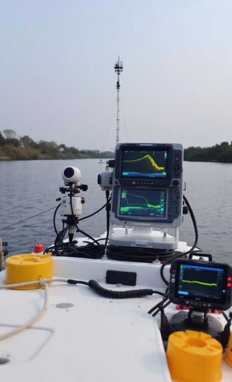
Koni Engineering provides hydrographic survey services for lakes, dams, rivers, ports and coastal areas, forming a basis for engineering projects. Hydrographic surveys include the determination of water depth, modeling of seabed morphology and technical analysis of underwater topography. Accurate and reliable hydrographic data is critical for infrastructure projects, dredging planning and hydraulic modeling studies. Therefore, we carry out the survey process using high-precision equipment and controlled data processing methods.
Surveying and Data Processing Process
We begin by analyzing the hydraulic and topographic characteristics of the project area. Survey lines and data density are planned in accordance with project requirements. In the field, depth measurements are carried out using single-beam or multi-beam echo sounder systems, while positional accuracy is ensured through RTK GNSS integration. Raw data is checked by considering water level variations and reference elevation corrections. In the office stage, noise filtering and error correction processes are applied. Isobath contours are then generated, a digital terrain model is created and required cross-sections and volume analyses are prepared. All outputs are delivered in the form of technical reports and digital data.
Areas of Application
Hydrographic survey services serve as a primary data source for reservoir and pond volume analyses, port and marina projects, dredging applications and hydroelectric power plant studies. They also directly influence the accuracy of engineering design in flood modeling and underwater structure projects. Through regular periodic surveys, sediment accumulation and seabed changes can be monitored, enabling more reliable long-term planning.
Hydrographic Survey Services
Koni Engineering plans and executes hydrographic survey operations as a comprehensive technical process. From project preparation to data evaluation, every stage is carried out using high-precision equipment and a professional engineering approach. The data produced meets the standards of accuracy and sustainability required for reliable use in projects, providing a strong and dependable data infrastructure for underwater engineering applications.
For more detailed information, you can visit our contact page and follow us on our social media accounts.